Future Cities
Hotels and Retail Absorb the Brunt of Helene’s Devastation
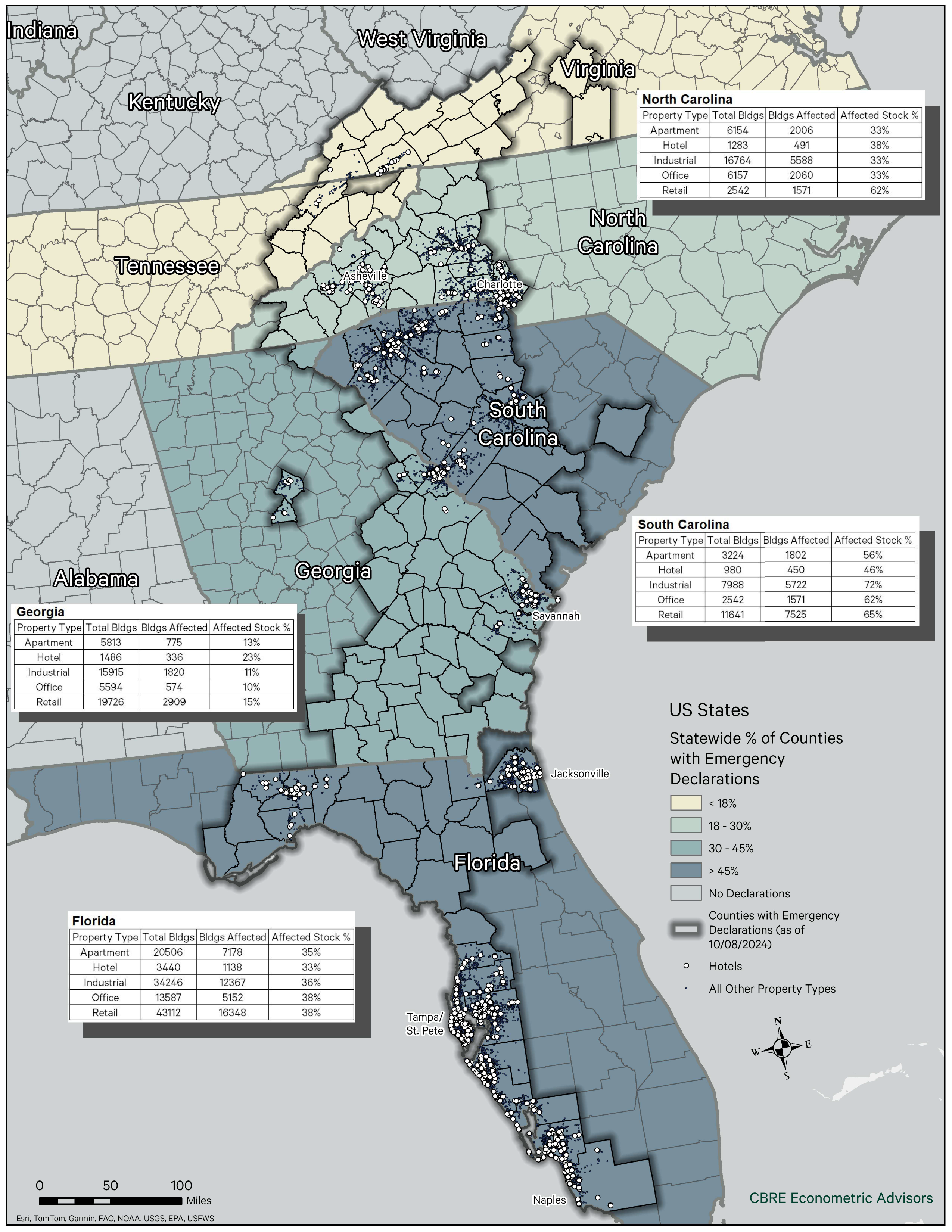
Map of the Month
October 30, 2024 2 Minute Read

Receive EA Insights Directly in your Inbox
CBRE Econometric Advisors’ map this month looks at the counties that were in the path of Hurricane Helene. We’ve highlighted the counties and color-coded the states based on FEMA-designated disaster areas or areas otherwise eligible for federal disaster-relief assistance. The dots represent commercial buildings within the hurricane impact zone.
Overall, hotel and retail properties in North Carolina were disproportionately impacted. This is not surprising given the devastation Helene wrought across western North Carolina, where the hospitality sector has been a strong economic growth driver during the past decade. Indeed, hotels and retail constitute twice the share of Asheville’s total commercial building stock than they do in Charlotte, a larger, more diversified market 130 miles to the east.
Figure 1: Counties with Emergency Declarations Due to Hurricane Helene
Contacts
Dennis Schoenmaker, Ph.D.
Global Head of Forecasting and Strategic Insight, Head of Data Centre of Excellence


