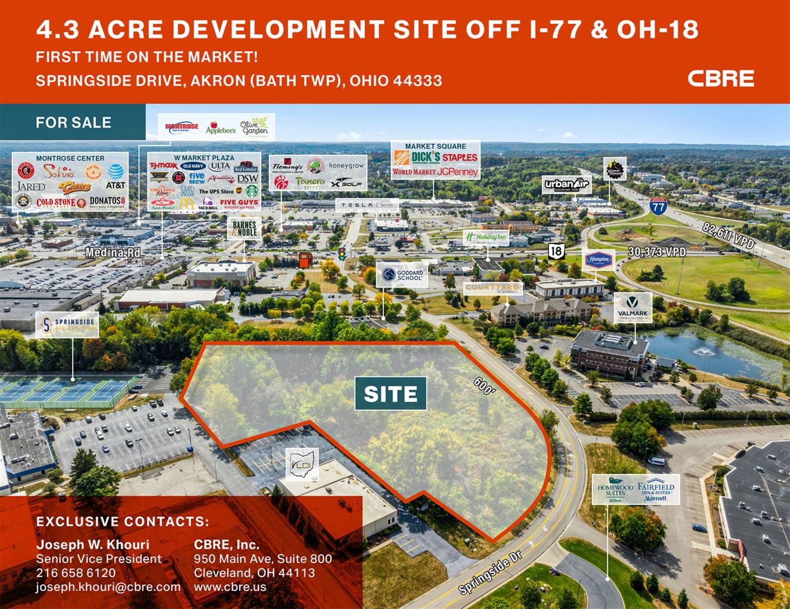
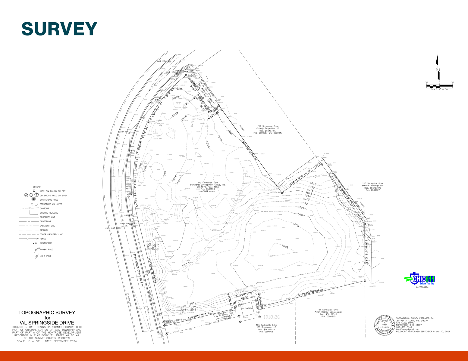
4.3 Acre Development Site off I-77 & OH-18 153 Springside Drive
Akron, OH 44333
For Sale
4.31 ac
Sale Price
$1,300,000
View Floor Plans
Brochure
Map
Land For Sale - Under Contract
First time on the market!
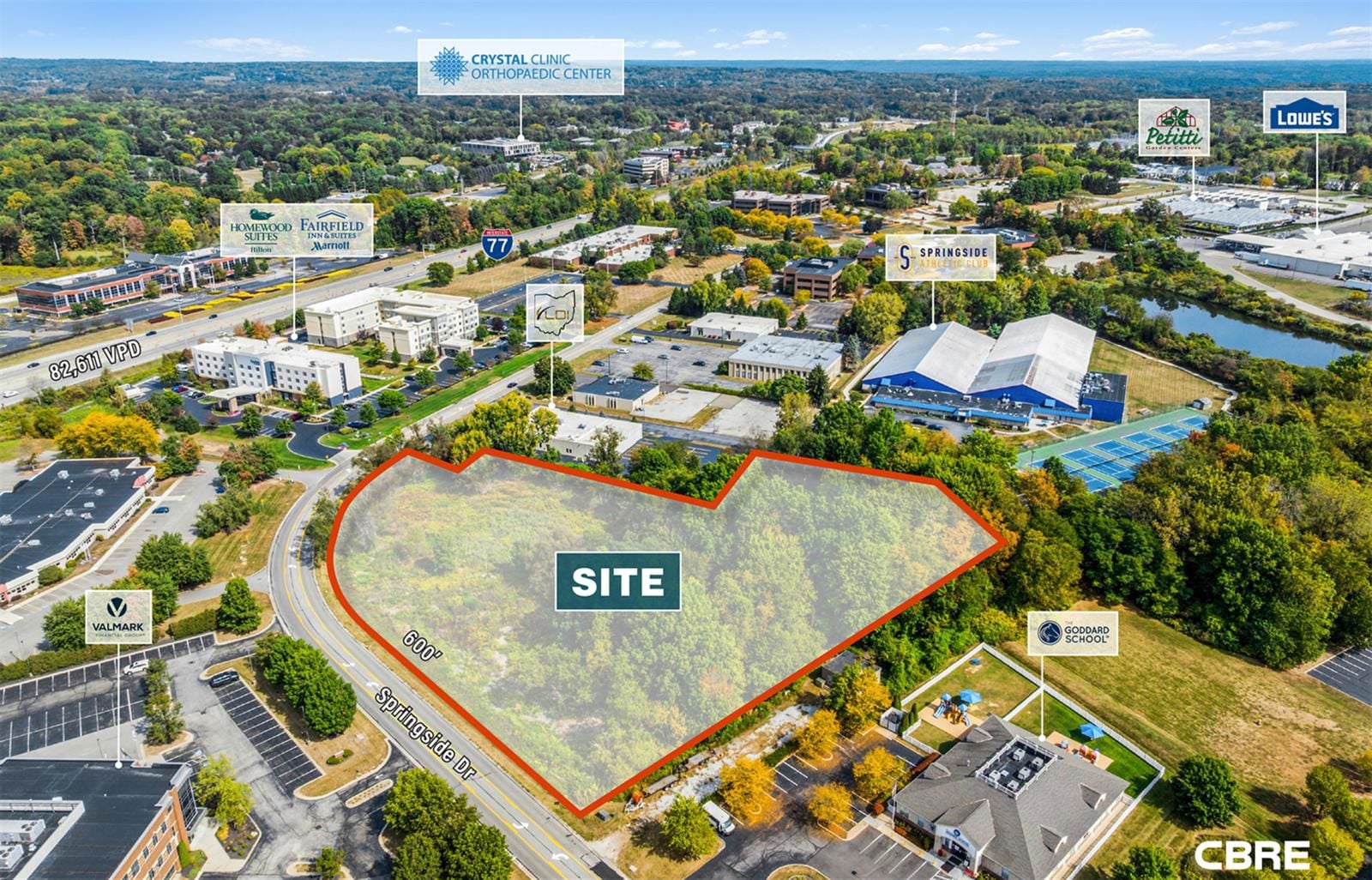
Property Location: The land is located on Springside Drive, under 1/2 mile away from the OH-18 exit off I-77, which features traffic counts over 30,373 VPD (Source: ODOT TIMS)
Zoning: B-3
Located in Bath Township (Akron)
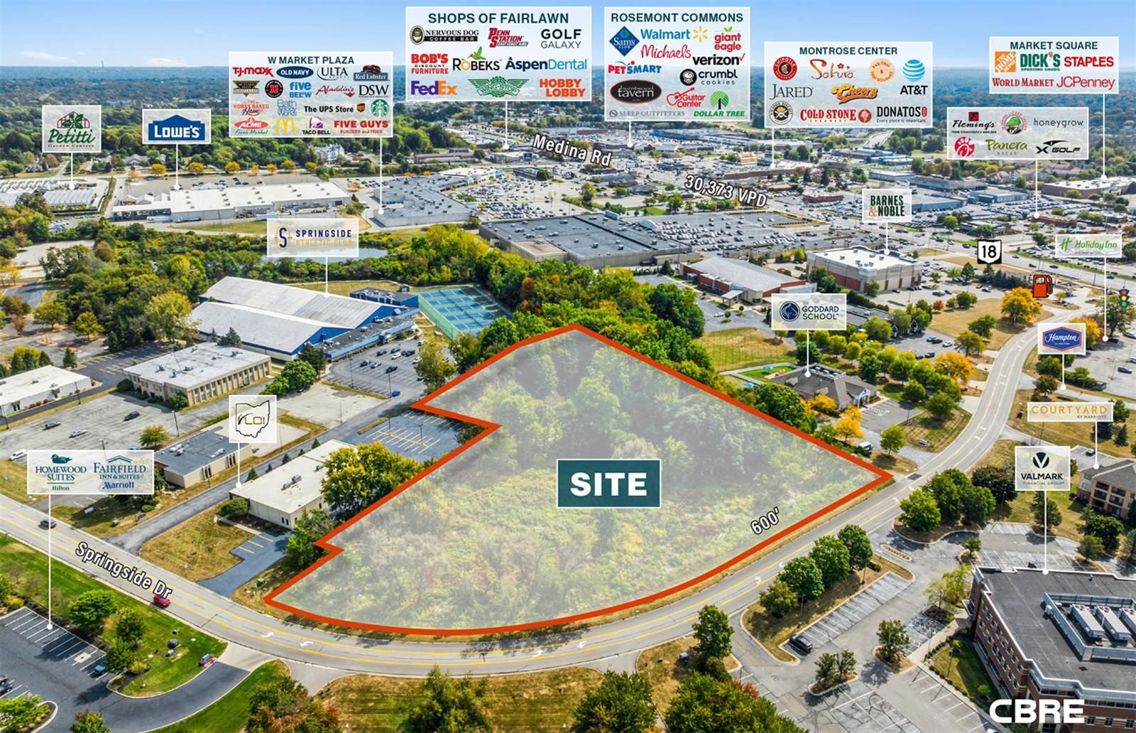
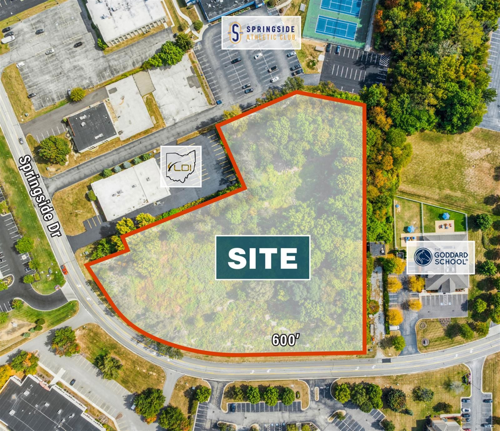
Frontage: Approx. 600’ ft
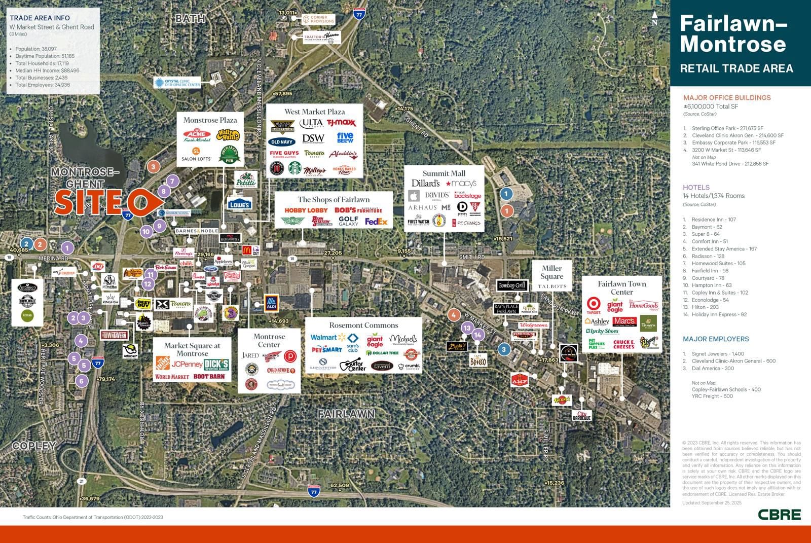
The property is located along an entry point to the robust Fairlawn / Montrose retail trade area, the primary super-regional trade area for the Northern Akron MSA
Incredible demographics: The Fairlawn/Montrose market has impressive average household incomes of $197,184 in a 3 mile radius
Daytime population of 208,315 people in a 15 minute drive time
Area retailers include Apple, Arhaus Furniture, Dillards, Coach, Altar’d State at SIMON’S Summit Mall, Lululemon, Target, Dicks Sporting Goods, Giant Eagle, Walmart, Sam’s Club, TJMaxx, and many more
Area restaurants include Flemings, Outback, Longhorn, BJ’s Brewhouse, Olive Garden, First Watch, CORE Life, Panera, City BBQ, PF Chang’s, Starbucks, 3 Ken Stewart’s restaurant concepts and many more
The market boasts 6.5 M SF of office space, with Signet Jewelers as the main employer with 1,900 employees!
Get in touch
Joseph Khouri

The subject site has direct access to water, sanitary sewer, storm sewer, gas, and electric services.
PARCEL ID: 0500590
PARCEL ID: 0500590
The subject site is zoned B-3 and is within the Bath Township, Ohio jurisdiction. The purpose of the B-3 Office, Research and Limited Business District is to provide an environment exclusively for and conducive to the development and protection of modern administrative facilities, offices, institutions, office-like research and sales facilities, and other similar or limited commercial activities.
The subject has an X classification by FEMA, which is a designation for land that is located outside of the 0.2% annual chance flood plain. The FEMA flood map for the subject is identified as Map Number 39153C0094F, Dated April 19, 2016.
The subject has an X classification by FEMA, which is a designation for land that is located outside of the 0.2% annual chance flood plain. The FEMA flood map for the subject is identified as Map Number 39153C0094F, Dated April 19, 2016.
Total Space Available
4.31 ac
Sale Price
$1,300,000
Get in touch
Joseph Khouri